Hike Mount Beerwah in the Glass House Mountains
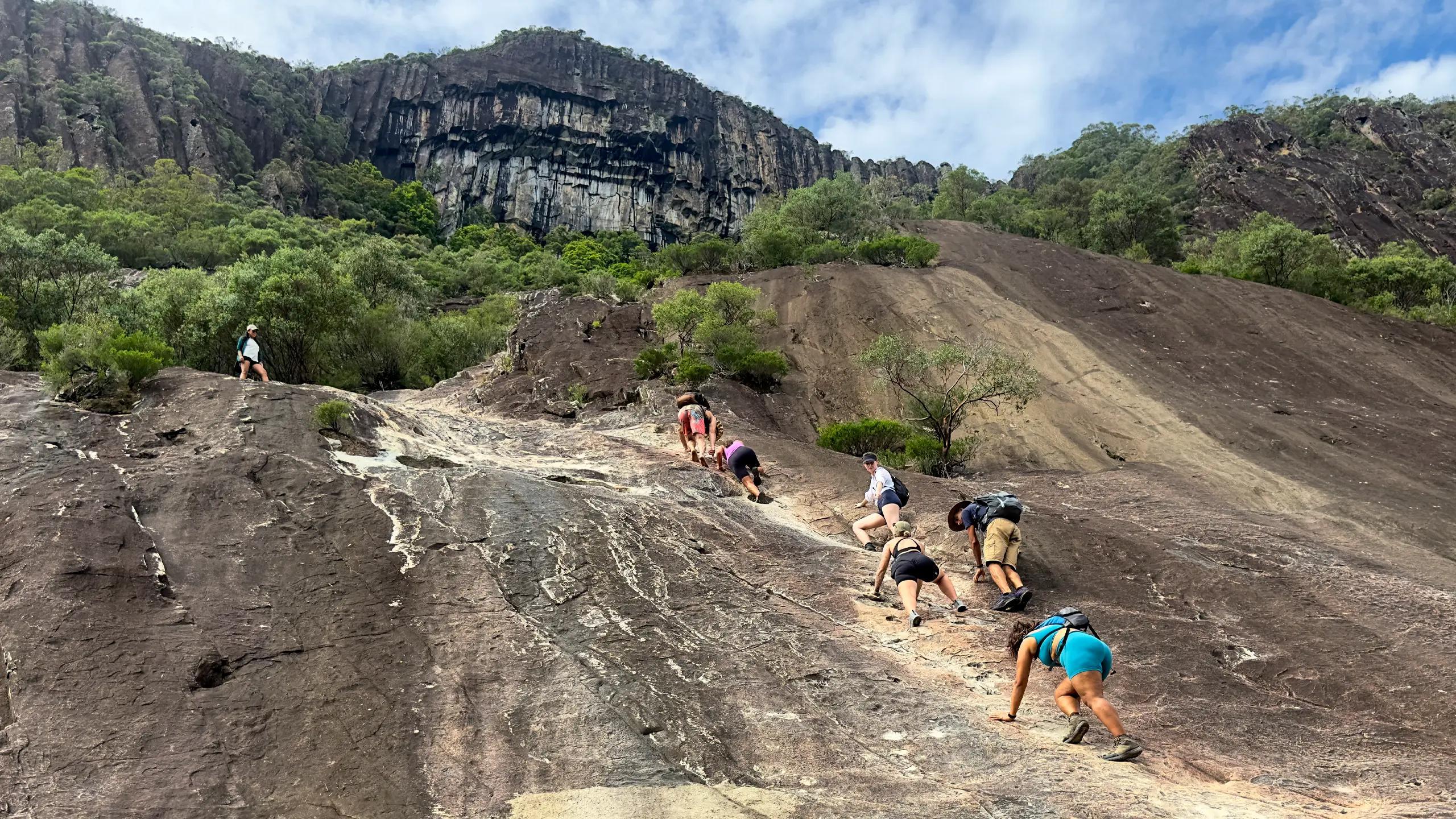
Nestled in the breathtaking Glass House Mountains National Park, Mt Beerwah stands as the highest peak, offering a thrilling adventure for outdoor enthusiasts. This challenging 4.3 km hike requires high fitness levels and rock scrambling skills, but the reward is well worth it.
With its towering presence and rugged terrain, Mt Beerwah presents a thrilling challenge for seasoned hikers and adventurers.
Spanning 4.3 Kms round trip, this Challenging hike demands high levels of fitness and some rock scrambling skills.
As you ascend through wet eucalypt forests and heath-covered slopes, you'll be rewarded with panoramic views of the Sunshine Coast, the Glass House peaks, and the sprawling D'Aguilar Range to the west.
A challenging 4.3 km hike that rewards you with stunning 360 degree views, offering an exhilarating journey through lush eucalypt forests, challenging ascents, and breathtaking vistas.
Trail Talk: A Breakdown of the Hike
Wild life
Keep your eyes peeled for diverse wildlife
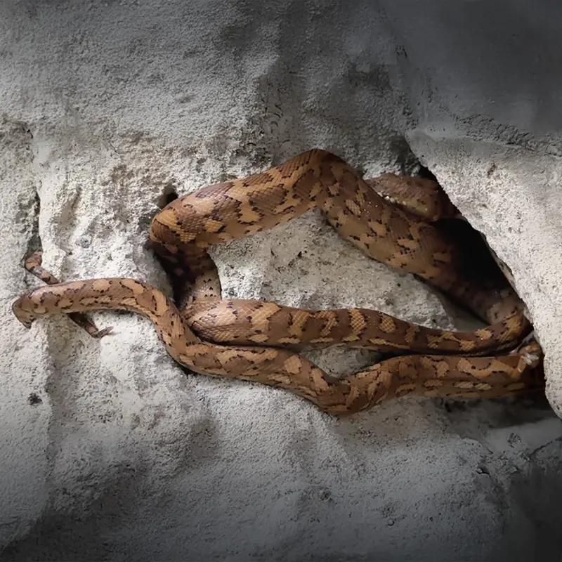
Carpet Python
The Carpet Python (Morelia spilota mcdowelli) is a non-venomous snake commonly found in Mt Beerwah caves. It uses its patterned scales for camouflage and preys on small animals. Despite its size, it is harmless unless threatened.
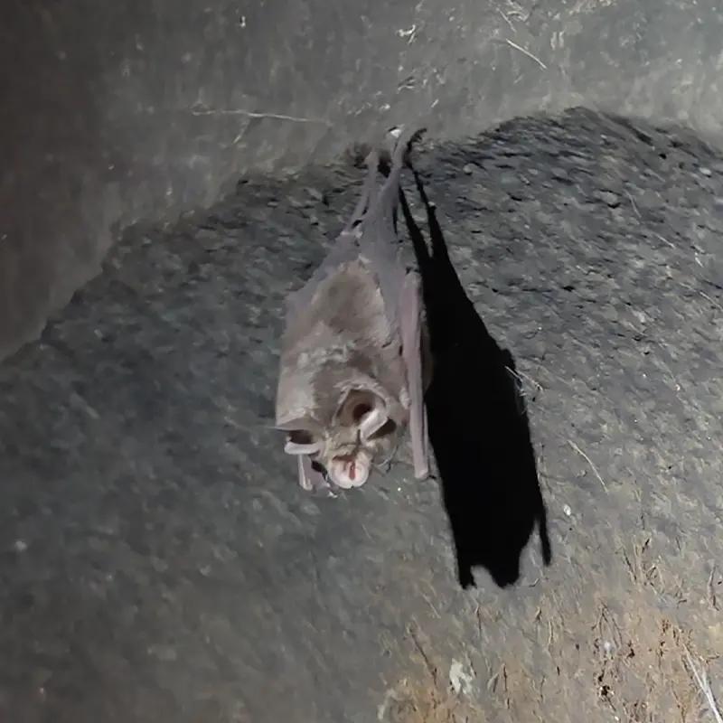
Northern Cave Bat
The Northern Cave Bat (Vespadelus caurinus) is a small insectivorous bat found in Mt Beerwah caves, Queensland. It roosts in crevices and hunts at night, using echolocation to catch insects. This species plays a vital role in controlling insect populations.
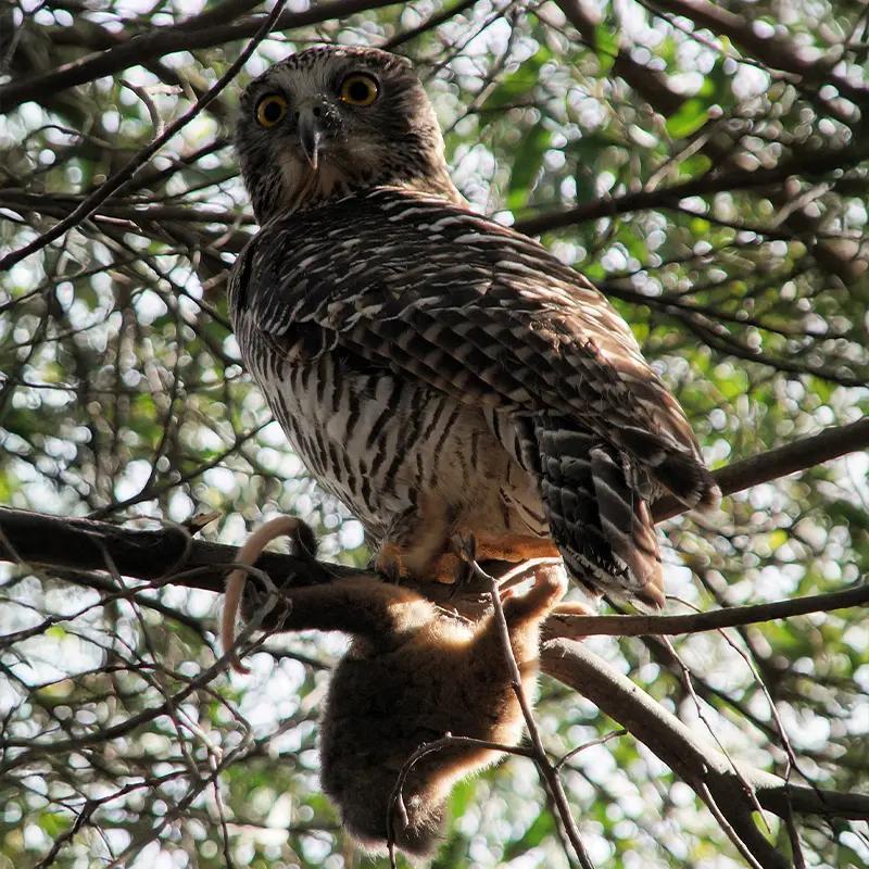
The Powerful owl
The powerful owl (Ninox strenua) is Australia's largest owl, found in coastal areas and the Great Dividing Range, typically within 200 km of the coast.
Is the Mt Beerwah Hike for You?
Mount Beerwah's summit route is no walk in the park. It's a challenging Hike requiring High Fitness, Experience, and Rock Scrambling Skills.
Steep, exposed sections and loose rocks demand Caution and Preparedness. This isn't suitable for inexperienced hikers or those seeking a casual stroll.
Indigenous Heritage and Cultural Respect
Before embarking on your adventure, it's important to acknowledge the cultural significance of Mt Beerwah to the Jinibara and Kabi Kabi peoples. According to Indigenous lore, Beerwah is revered as the ancestral, pregnant mother—a symbol of profound spiritual importance.
Comparison of Queensland's most challengin hikes

Comparison of various mountains in Queensland including height, distance, length and elevation gain.
Elevation gain and distance are important factors when assessing a hike, especially when considering Mt. Beerwah. Elevation gain indicates how much you'll climb, and with Mt. Beerwah's peak standing at 556 mts, this mountain involves a significant uphill climb that will test your stamina. The distance, typically around 4.3 kms round trip, shows the ground you'll need to cover. Also, the steep, rocky terrain will demand additional physical skills including endurance, leg strength, and balance. By understanding and evaluating these aspects, you can be better prepared for this challenging hike.
Hiking Tips and Checklists:
Before You Lace Up!
Here are some key recommendations to enhance your Mt Beerwah experience:
- Do Your Research:Thoroughly understand the physical demands, potential risks, and weather conditions, a Mt Beerwah Trail Map would come in handy.
- Check the Forecast: Ensure clear skies and dry conditions before starting.
- Pack Essentials: Bring sunscreen, snacks, and a first-aid kit for emergencies.
- Stay Hydrated: Queensland's climate can be hot and dry. Carry at least 3 litres of water to stay hydrated throughout the hike.
- Safety in Numbers: Hike with a buddy if possible, especially if you're not experienced with the trail. Consider going with someone who's hiked Mount Beerwah before
- Wear Sturdy Footwear: Opt for supportive footwear with a good grip to navigate rocky terrain.
Pack Checklist:
- Water bottles or hydration pack
- Food/snacks for the day
- First-aid kit
- Hiking Boots or Sturdy Shoes
- Sunscreen
- Mt Beerwah Trail map: Alltrails map
- Extra clothing layers (depending on weather conditions)
Pro Tip:
Start Early: Begin your hike in the early hours of the day to avoid harsh midday sun and potential crowds. Early mornings offer cooler temperatures and clearer views, enhancing your overall hiking experience.
Mt Beerwah Route and Trail Notes
From parking to summit: The hike starts from the Mount Beerwah picnic area car park, where hikers traverse exposed trails and rocky terrain. While the Beerwah North Face Summit Track, also known as the "Hikers' Route," is the most accessible path, it poses challenges with steep climbs and sheer rock faces. As you navigate the trail, exercise caution, especially during wet conditions, and adhere to safety guidelines to ensure a safe and enjoyable hike.
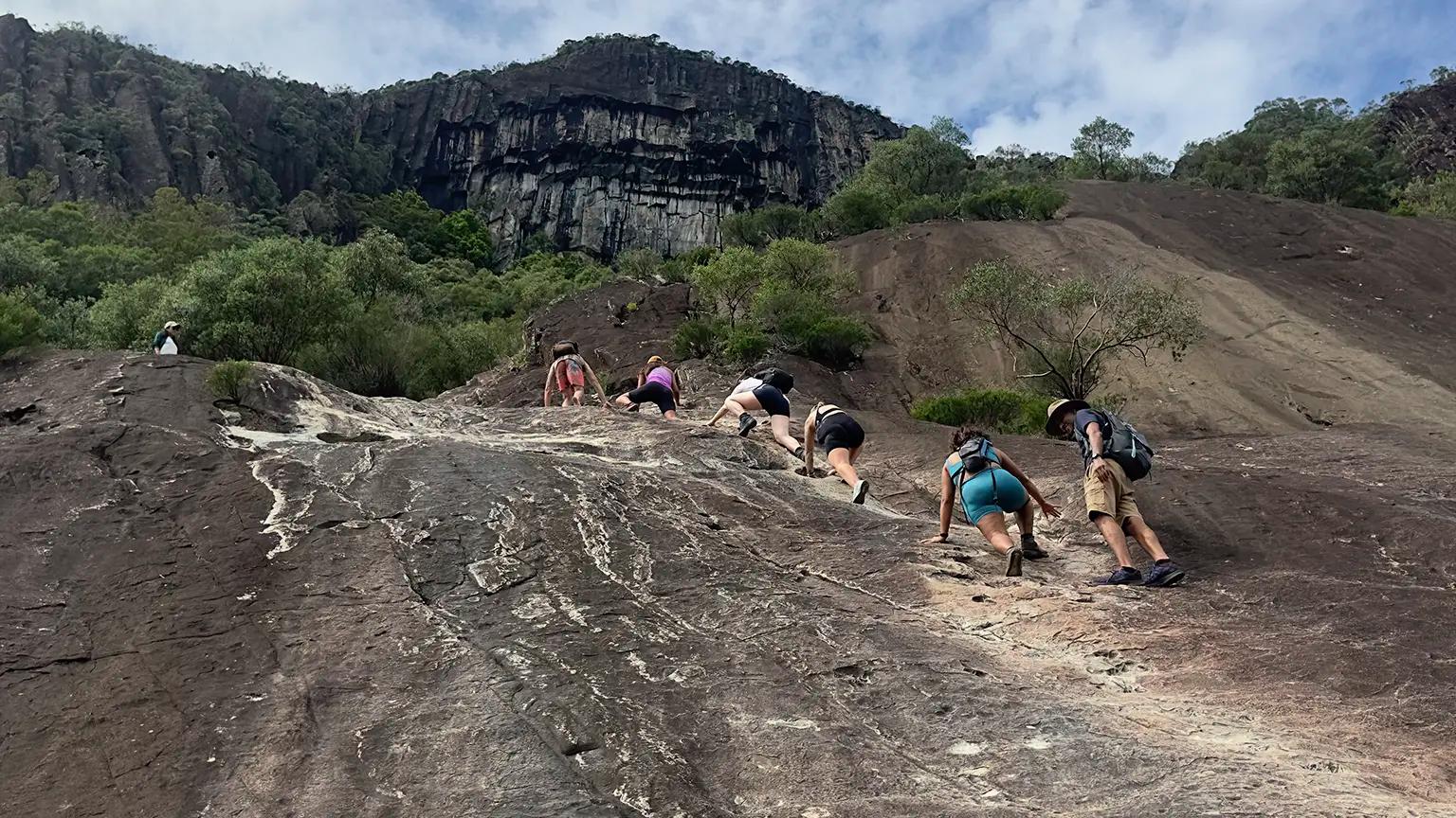
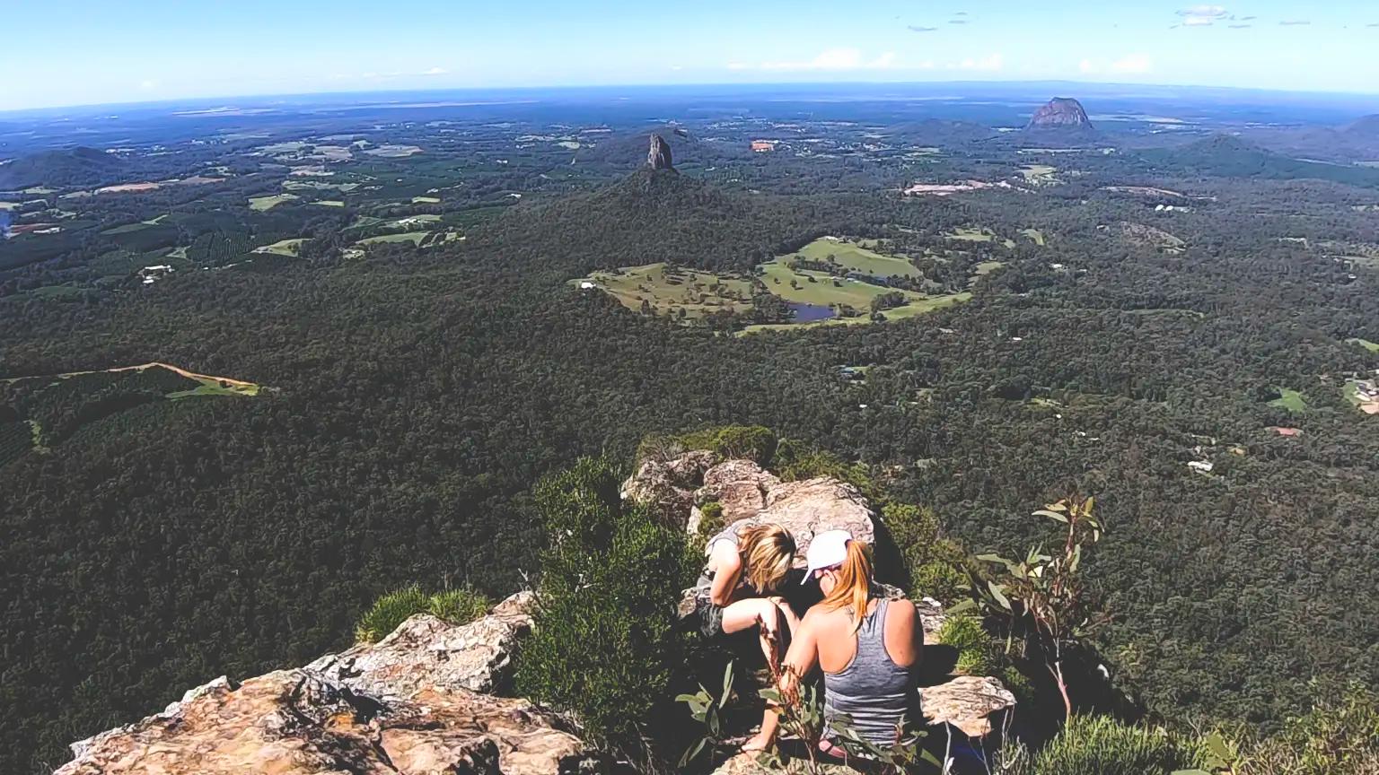
Summit Views at Mt Beerwah: A Majestic Panorama
At the summit of Mt Beerwah, hikers are treated to a breathtaking panorama. Coastal landscapes sprawl out, the Glass House Mountains stand proudly, and the D'Aguilar Range graces the western horizon. While some may suggest a sunrise hike, where dawn paints the sky with hues of orange and gold, the beauty of Mt Beerwah is equally mesmerizing at any time of day. Standing atop this peak offers a moment of tranquility and reverence amidst nature's grandeur.
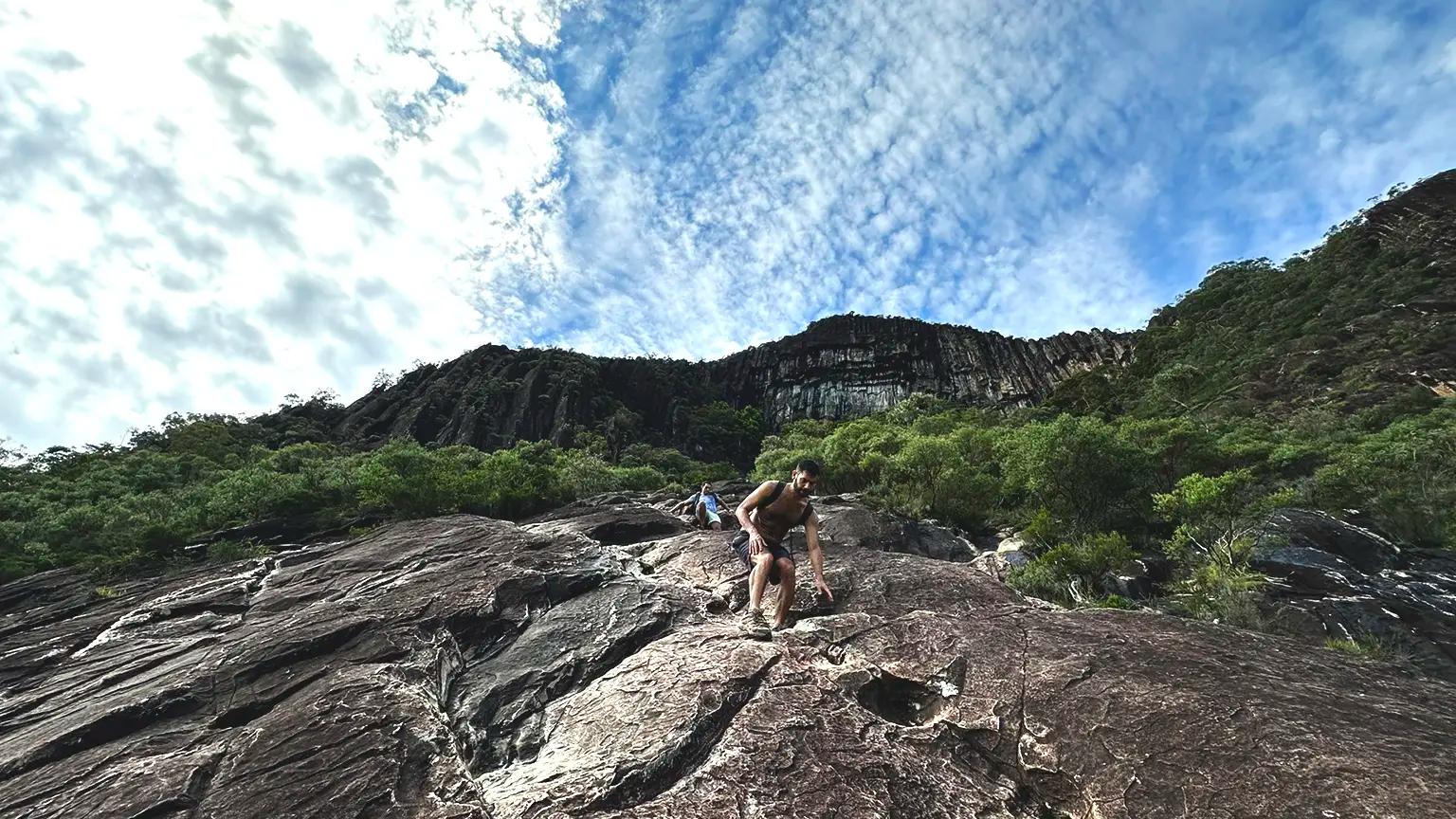
Descending from Mt Beerwah
Descending from Mt Beerwah can be just as challenging as the ascent, requiring careful navigation and concentration. As you make your way down the mountain, be mindful of the steep terrain, loose rocks, and potential hazards along the trail. Here are some tips for a safe and smooth descent:
Take Your Time:Descend slowly, mindful of steep terrain and loose rocks.
Use Your Bum for Support:In certain sections, utilize your bum to slide down gently, ensuring stability.
Stay Oriented:Without trail markers, rely on mental landmarks to stay on course.
Pro Tip:
Early Start: Start Early: Begin your hike in the early hours of the day to avoid harsh midday sun and potential crowds. Early mornings offer cooler temperatures and clearer views, enhancing your overall hiking experience.
FAQs:
What is the best time of year to hike Mt Beerwah?
The best time to hike Mt Beerwah is during the cooler months, from autumn to spring, to avoid the heat and humidity of the Queensland summer. However, always check weather forecasts before heading out and be prepared for changing conditions.
How long does it take to hike to the summit of Mt Beerwah?
The hike to the summit of Mt Beerwah typically takes around 1.5 to 2.5 hours, depending on your fitness level and hiking pace. It's important to allow enough time for breaks and to enjoy the scenery along the way.
Are there any safety concerns I should be aware of when hiking Mt Beerwah?
Yes, hiking Mt Beerwah involves some risks, including steep climbs, rocky terrain, and exposure to the elements. It's important to wear appropriate footwear and be mindful of weather conditions. Avoid hiking during wet or stormy weather.
Can I bring my dog on the hike to Mt Beerwah?
No, pets are not permitted on the hiking trails at Mt Beerwah out of respect for the environment and Indigenous cultural traditions.
Are there facilities such as toilets and picnic areas available at Mt Beerwah?
Yes, there are toilet facilities and picnic areas available at the base of Mt Beerwah for visitors' convenience.
Is camping allowed at Mt Beerwah?
No, camping is not permitted at Mt Beerwah. Visitors are encouraged to explore the area during the day and return home or find accommodation in nearby towns for overnight stays.
Can I climb Mt Beerwah if I have a fear of heights?
Climbing Mt Beerwah involves steep ascents and exposure to heights, making it challenging for individuals with a fear of heights. It's important to assess your comfort level with heights and rock scrambling before attempting the hike.